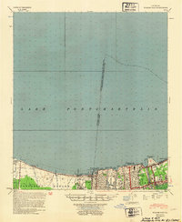
1953 Map of Spanish Fort
USGS Topo · Published 1954About this map
The southern shoreline of Lake Pontchartrain reveals a highly engineered landscape in the mid-20th century, defined by an intricate network of drainage and transport infrastructure. The Corps of Engineers and U.S. Army documentation highlights the critical role of water management in Jefferson Parish and Orleans Parish, featuring numerous outfall canals such as the London Ave Outfall Canal and the Metairie Relief Outfall Canal.
Find a feature on this map
48 named features on this map. Tap any name to fly to it.
Don’t see what you’re looking for? This feature index may not catch every label — zoom into the map to look around manually.
Map Details
Editions of this 1953 Spanish Fort Map
This is the sole edition of this map. No revisions or reprints were ever made.
Other maps of this area

1891 · Hahnville
USGS Topo · 1:62,500

1891 · Spanish Fort
USGS Topo · 1:62,500

1891 · New Orleans
USGS Topo · 1:62,500

1892 · Chef Menteur
USGS Topo · 1:62,500

1892 · Bonnet Carre
USGS Topo · 1:62,500

1892 · St. Bernard
USGS Topo · 1:62,500

1932 · New Orleans NE
USGS Topo · 1:31,680

1932 · New Orleans NW
USGS Topo · 1:31,680

1932 · Hahnville NE
USGS Topo · 1:31,680

1935 · Slidell
USGS Topo · 1:62,500