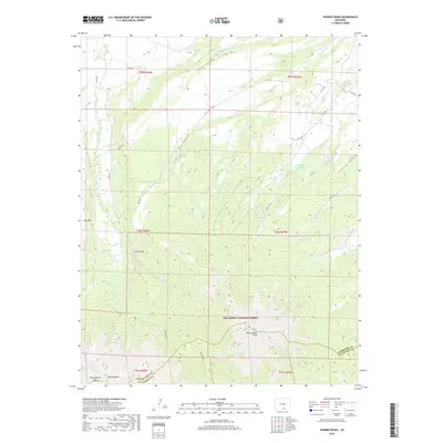
2019 Map of Spanish Peaks
USGS Topo · Published 2019About this map
East Spanish Peak and West Spanish Peak dominate the southern landscape of this Colorado quadrangle, marking the dramatic elevation changes within the San Isabel National Forest. The map details a complex drainage system across the Huerfano and Las Animas county line, where headwaters like the N Fork Trujillo Cr and N Santa Clara Cr begin their descent from the high peaks. North of the summits, the terrain is carved by deep passages such as Long Canyon and Dry Canyon, illustrating the erosional forces that have shaped this portion of the Sangre de Cristo Mountains.
Find a feature on this map
38 named features on this map. Tap any name to fly to it.
Don’t see what you’re looking for? This feature index may not catch every label — zoom into the map to look around manually.
Map Details
Editions of this 2019 Spanish Peaks Map
This is the sole edition of this map. No revisions or reprints were ever made.
Other maps of this area

1889 · Huerfano Park
USGS Topo · 1:125,000

1891 · Walsenburg
USGS Topo · 1:125,000

1891 · Spanish Peaks
USGS Topo · 1:125,000

1892 · Huerfano Park
USGS Topo · 1:125,000

1893 · Spanish Peaks
USGS Topo · 1:125,000

1894 · Walsenburg
USGS Topo · 1:125,000

1895 · Spanish Peaks
USGS Topo · 1:125,000

1897 · Walsenburg
USGS Topo · 1:125,000

1897 · Spanish Peaks
USGS Topo · 1:125,000

1900 · Spanish Peaks
USGS Topo · 1:125,000