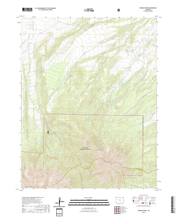
2022 Map of Spanish Peaks
USGS Topo · Published 2022About this map
Spanish Peaks dominates the southern landscape of this Colorado high country, where the dramatic volcanic landforms of East Spanish Peak and West Spanish Peak rise sharply above the San Isabel National Forest. The topography is defined by the unique radial dikes of the region, including the massive granite verticality of Big Wall and the overlook at Lovers Leap. This 2022 survey details a complex hydrologic network feeding into the surrounding basins, with mountain drainages like Wahatoya Cr and Story Cr flowing toward agricultural infrastructure such as Salas Ditch Reservoir and Brunelli Reservoir. Modern hikers and researchers can trace the rugged ascent of the Wahatoya Trl as it climbs the northern slopes, providing a contemporary record of trail access and natural resources like McDonald Spring at the boundary of Huerfano and Las Animas counties.
Find a feature on this map
39 named features on this map. Tap any name to fly to it.
Don’t see what you’re looking for? This feature index may not catch every label — zoom into the map to look around manually.
Map Details
Editions of this 2022 Spanish Peaks Map
This is the sole edition of this map. No revisions or reprints were ever made.
Other maps of this area

1889 · Huerfano Park
USGS Topo · 1:125,000

1891 · Walsenburg
USGS Topo · 1:125,000

1891 · Spanish Peaks
USGS Topo · 1:125,000

1892 · Huerfano Park
USGS Topo · 1:125,000

1893 · Spanish Peaks
USGS Topo · 1:125,000

1894 · Walsenburg
USGS Topo · 1:125,000

1895 · Spanish Peaks
USGS Topo · 1:125,000

1897 · Walsenburg
USGS Topo · 1:125,000

1897 · Spanish Peaks
USGS Topo · 1:125,000

1900 · Spanish Peaks
USGS Topo · 1:125,000