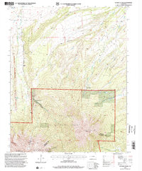
1994 Map of Spanish Peaks
USGS Topo · Published 2001About this map
East Spanish Peak and West Spanish Peak dominate this landscape on the boundary of Huerfano and Las Animas counties. Much of the southern half of the map is protected within the San Isabel National Forest, featuring the massive geologic formation known as the Big Wall. The map reveals a history of early mountain education and recreation, preserved through the site of the Wahatoya School and the Santa Fe Trail Council Camp.
Find a feature on this map
23 named features on this map. Tap any name to fly to it.
Don’t see what you’re looking for? This feature index may not catch every label — zoom into the map to look around manually.
Map Details
Editions of this 1994 Spanish Peaks Map
This is the sole edition of this map. No revisions or reprints were ever made.
Other maps of this area

1889 · Huerfano Park
USGS Topo · 1:125,000

1891 · Walsenburg
USGS Topo · 1:125,000

1891 · Spanish Peaks
USGS Topo · 1:125,000

1892 · Huerfano Park
USGS Topo · 1:125,000

1893 · Spanish Peaks
USGS Topo · 1:125,000

1894 · Walsenburg
USGS Topo · 1:125,000

1895 · Spanish Peaks
USGS Topo · 1:125,000

1897 · Walsenburg
USGS Topo · 1:125,000

1897 · Spanish Peaks
USGS Topo · 1:125,000

1900 · Spanish Peaks
USGS Topo · 1:125,000