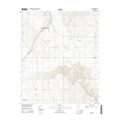
2015 Map of Sparta
USGS Topo · Published 2015About this map
The Natchez Trace Parkway and National Scenic Trail curves through the western portion of this landscape, tracing an ancient route through the borderlands of Chickasaw and Clay counties. The area is defined by a dense network of tributaries including Houlka Creek, Chico Creek, and Cane Creek, which carve through the terrain south of the small settlements of Sonora and Enon.
Find a feature on this map
63 named features on this map. Tap any name to fly to it.
Don’t see what you’re looking for? This feature index may not catch every label — zoom into the map to look around manually.
Map Details
Editions of this 2015 Sparta Map
This is the sole edition of this map. No revisions or reprints were ever made.
Other maps of this area

1953 · West Point
USGS Topo · 1:250,000

1958 · West Point
USGS Topo · 1:250,000

1959 · Van Vleet
USGS Topo · 1:62,500

1959 · Pheba
USGS Topo · 1:62,500

1963 · West Point
USGS Topo · 1:250,000
1972 · Houston West
USGS Topo · 1:24,000

1972 · Mantee
USGS Topo · 1:24,000
1972 · Woodland
USGS Topo · 1:24,000

1982 · West Point
USGS Topo · 1:100,000

1984 · West Point
USGS Topo · 1:250,000