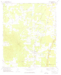
1972 Map of Woodland
USGS Topo · Published 1974About this map
Woodland sits at the heart of this North Mississippi landscape, where the Gulf Central Illinois railroad and the Natchez Trace Parkway create a distinct transportation corridor through the rural countryside. The town's surroundings are defined by a network of creek bottoms, including Chewawah Creek and Little Cane Creek, interspersed with agricultural clearings and small rural settlements like Tabbville and Anchor.
Find a feature on this map
29 named features on this map. Tap any name to fly to it.
Don’t see what you’re looking for? This feature index may not catch every label — zoom into the map to look around manually.
Map Details
Editions of this 1972 Woodland Map
This is the sole edition of this map. No revisions or reprints were ever made.
Other maps of this area

1953 · West Point
USGS Topo · 1:250,000

1958 · West Point
USGS Topo · 1:250,000

1959 · Van Vleet
USGS Topo · 1:62,500

1959 · Pheba
USGS Topo · 1:62,500

1963 · West Point
USGS Topo · 1:250,000

1972 · Atlanta
USGS Topo · 1:24,000

1972 · Vardaman
USGS Topo · 1:24,000

1972 · Hohenlinden
USGS Topo · 1:24,000
1972 · Houston West
USGS Topo · 1:24,000

1972 · Mantee
USGS Topo · 1:24,000