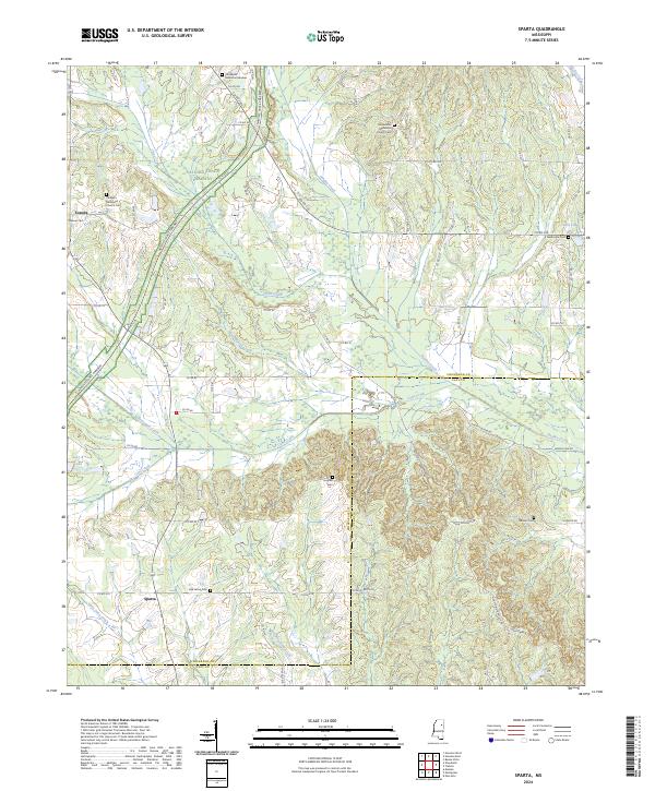
2024 Map of Sparta
USGS Topo · Published 2024About this map
Sparta and Sonora anchor this rural landscape in North Mississippi, where the historical topography is defined by a network of creeks and small family cemeteries. The Natchez Trace Parkway cuts diagonally through the northwest corner, following the ancient trade and travel route that shaped this region's early development. The map reveals a high density of religious and burial sites for a rural area, including the Macedonia Methodist Church Cem and the Prospect Methodist Church Cem, suggesting a long-established community structure centered around these small rural intersections.
Find a feature on this map
68 named features on this map. Tap any name to fly to it.
Don’t see what you’re looking for? This feature index may not catch every label — zoom into the map to look around manually.
Map Details
Editions of this 2024 Sparta Map
This is the sole edition of this map. No revisions or reprints were ever made.
Other maps of this area

1953 · West Point
USGS Topo · 1:250,000

1958 · West Point
USGS Topo · 1:250,000

1959 · Van Vleet
USGS Topo · 1:62,500

1959 · Pheba
USGS Topo · 1:62,500

1963 · West Point
USGS Topo · 1:250,000
1972 · Houston West
USGS Topo · 1:24,000

1972 · Mantee
USGS Topo · 1:24,000
1972 · Woodland
USGS Topo · 1:24,000

1982 · West Point
USGS Topo · 1:100,000

1984 · West Point
USGS Topo · 1:250,000