1909 Map of Sparta
USGS Topo · Published 1919About this map
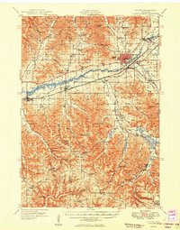
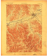
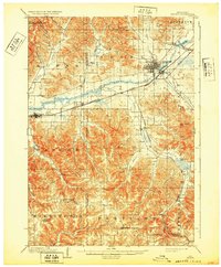
Sparta serves as the focal point of this early twentieth-century survey, situated at the confluence of the La Crosse River and Beaver Creek. The landscape is defined by the heavy incision of coulees and valleys, such as Burnham Creek Valley and Farmers Valley, which dictated the early transportation corridors of the region. Two major rail lines, the Chicago Milwaukee and St Paul and the Chicago and Northwestern, parallel each other through the river valley, connecting settlements like Rockland and Bangor. In the southern half of the quadrangle, the terrain becomes increasingly complex as the ridge-and-valley system creates natural boundaries for rural hamlets like Middle Ridge and Newberg Corners. The mapping reveals a transition from the industrial and rail-centered activity in the north to the more secluded, small-scale farming communities found near Portland and Melvina.
Find a feature on this map
46 named features on this map. Tap any name to fly to it.
Don’t see what you’re looking for? This feature index may not catch every label — zoom into the map to look around manually.
Map Details
Editions of this 1909 Sparta Map
3 editions found

Historical Maps of Sparta Through Time
6 maps found