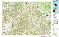
1985 Map of Sparta
USGS Topo · Published 1990About this map
The Fort McCoy Military Reservation dominates the northern reaches of this mid-1980s landscape, illustrating the significant federal footprint in Monroe County. The map details a transition from the agricultural lowlands of the La Crosse River and Lemonweir River valleys into the distinctive ridge-and-coulee topography of the Driftless Area. This is most evident in the complex terrain surrounding Wildcat Mountain State Park and the various family-named ridges like Potter Ridge and Bohemian Ridge.
Find a feature on this map
177 named features on this map. Tap any name to fly to it.
Don’t see what you’re looking for? This feature index may not catch every label — zoom into the map to look around manually.
Map Details
Editions of this 1985 Sparta Map
2 editions found
Other maps of this area

1901 · Denzer
USGS Topo · 1:62,500

1901 · The Dells
USGS Topo · 1:62,500

1903 · Waukon
USGS Topo · 1:125,000

1905 · Richland Center
USGS Topo · 1:125,000

1909 · Sparta
USGS Topo · 1:62,500

1916 · Tomah
USGS Topo · 1:62,500

1919 · Kendall
USGS Topo · 1:62,500

1921 · Mauston
USGS Topo · 1:62,500

1921 · Kendall
USGS Topo · 1:62,500

1923 · Viroqua
USGS Topo · 1:62,500