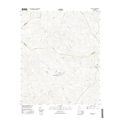
2017 Map of Sparta NW
USGS Topo · Published 2017About this map
The settlement of Springfield serves as a central point in this rural landscape, where family heritage is deeply etched into the geography through numerous small burial grounds. Genealogists will find a wealth of specific family landmarks, such as the Hilsman - Lary Family Cem, Hubert Family Cem, and Cooper Family Cem, which are scattered among the tributaries of Whitten Cr and Battle Br. To the east, the village of Powelton is marked by the Powelton Cem and Powelton Community Cem, situated near the headwaters of Beaverdam Cr. The northern reaches of the map are defined by the winding course of the Ogeechee River, while the road network, including the Springfield Powelton Rd and Sparta Rd SE, connects these dispersed communities across the tri-county border area of Greene, Taliaferro, and Hancock counties.
Find a feature on this map
52 named features on this map. Tap any name to fly to it.
Don’t see what you’re looking for? This feature index may not catch every label — zoom into the map to look around manually.
Map Details
Editions of this 2017 Sparta NW Map
This is the sole edition of this map. No revisions or reprints were ever made.
Other maps of this area

1906 · Crawfordville
USGS Topo · 1:125,000

1953 · Athens
USGS Topo · 1:250,000

1958 · Athens
USGS Topo · 1:250,000

1959 · Athens
USGS Topo · 1:250,000

1963 · Athens
USGS Topo · 1:250,000

1965 · Union Point
USGS Topo · 1:24,000

1966 · Crawfordville
USGS Topo · 1:24,000

1972 · Shoulderbone
USGS Topo · 1:24,000

1972 · Sharon
USGS Topo · 1:24,000

1972 · Sparta NW
USGS Topo · 1:24,000