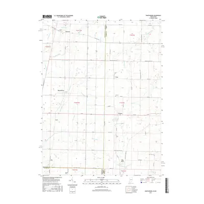
2016 Map of Spartanburg
USGS Topo · Published 2016About this map
Hoosier Hill, the highest natural point in Indiana, sits quietly at the southern edge of this survey along the border of Randolph Co and Wayne Co. This landscape is defined by the headwaters of numerous small waterways, including Green Br, Slow Run, and Spartanburg Cr, which drain the agricultural plains straddling the Indiana and Ohio state line. The settlement pattern is dominated by crossroads communities like Spartanburg, Crete, and Arba, many of which maintain their local identity through historic burial grounds such as Clemens Cem and Bass Cem. The eastern portion of the map extends into Darke Co, Ohio, showing the transition from Bartonia Run to the drainage of Kraut Cr. This area represents a classic Midwestern agrarian corridor where the township and range system dictates the grid of rural roads and property lines.
Find a feature on this map
62 named features on this map. Tap any name to fly to it.
Don’t see what you’re looking for? This feature index may not catch every label — zoom into the map to look around manually.
Map Details
Editions of this 2016 Spartanburg Map
This is the sole edition of this map. No revisions or reprints were ever made.
Other maps of this area

1915 · New Paris
USGS Topo · 1:48,000

1916 · Winchester
USGS Topo · 1:48,000

1918 · Winchester
USGS Topo · 1:62,500

1918 · New Paris
USGS Topo · 1:62,500

1943 · Winchester
USGS Topo · 1:62,500

1953 · Cincinnati
USGS Topo · 1:250,000

1953 · Muncie
USGS Topo · 1:250,000

1956 · Muncie
USGS Topo · 1:250,000

1957 · Cincinnati
USGS Topo · 1:250,000

1960 · Union City
USGS Topo · 1:24,000