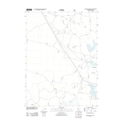
2012 Map of Spaulding Butte
USGS Topo · Published 2012About this map
Meares and Hackamore anchor this section of Modoc County, situated along the corridor of State Route 139. The landscape is defined by its water management and volcanic terrain, with multiple catchment systems like Whitney Reservoir and Spaulding Reservoir dotting the high-desert environment. These water sources, including the isolated Cannon Tank and Henski Reservoir, suggest a legacy of ranching or forest service infrastructure essential for sustaining life and livestock in this arid region.
Find a feature on this map
26 named features on this map. Tap any name to fly to it.
Don’t see what you’re looking for? This feature index may not catch every label — zoom into the map to look around manually.
Map Details
Editions of this 2012 Spaulding Butte Map
This is the sole edition of this map. No revisions or reprints were ever made.
Other maps of this area

1886 · Modoc Lava Bed
USGS Topo · 1:250,000

1892 · Modoc Lava-Bed
USGS Topo · 1:250,000

1952 · Timber Mountain
USGS Topo · 1:62,500

1952 · Hackamore
USGS Topo · 1:62,500

1954 · Alturas
USGS Topo · 1:250,000

1958 · Alturas
USGS Topo · 1:250,000

1962 · Alturas
USGS Topo · 1:250,000

1962 · Crank Mountain
USGS Topo · 1:62,500

1962 · White Horse
USGS Topo · 1:62,500

1965 · Alturas
USGS Topo · 1:250,000