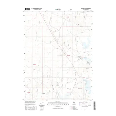
2015 Map of Spaulding Butte
USGS Topo · Published 2015About this map
Modoc National Forest encompasses the high-altitude volcanic landscape of this region, characterized by a complex system of water management and timber-related infrastructure. The Great Northern Line cuts a direct diagonal through the territory, passing near the settlement of Meares. This era of the landscape is defined by its reservoirs, including Whitney Reservoir, Hackamore Reservoir, and Spaulding Reservoir, which support the arid surroundings. The presence of features like Cannon Tank and Damons Cave suggests a history of local livestock management or natural exploration. Geologic formations dominate the horizon, from the prominent Plum Ridge to the volcanic profiles of Spaulding Butte and Damons Butte. These landmarks, along with family-named routes such as Tichnor Road, provide a detailed geography for those studying the intersection of rail transport and forest resource management in northern California.
Find a feature on this map
33 named features on this map. Tap any name to fly to it.
Don’t see what you’re looking for? This feature index may not catch every label — zoom into the map to look around manually.
Map Details
Editions of this 2015 Spaulding Butte Map
This is the sole edition of this map. No revisions or reprints were ever made.
Other maps of this area

1886 · Modoc Lava Bed
USGS Topo · 1:250,000

1892 · Modoc Lava-Bed
USGS Topo · 1:250,000

1952 · Timber Mountain
USGS Topo · 1:62,500

1952 · Hackamore
USGS Topo · 1:62,500

1954 · Alturas
USGS Topo · 1:250,000

1958 · Alturas
USGS Topo · 1:250,000

1962 · Alturas
USGS Topo · 1:250,000

1962 · Crank Mountain
USGS Topo · 1:62,500

1962 · White Horse
USGS Topo · 1:62,500

1965 · Alturas
USGS Topo · 1:250,000