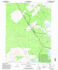
1993 Map of Spaulding Butte
USGS Topo · Published 1997About this map
Modoc National Forest dominates this landscape, characterized by the volcanic plateaus of Doublehead and Devils Garden. In the early 1990s, this area retained a remote character, centered on natural landmarks like Plum Ridge and Spaulding Butte. Human infrastructure is sparse, with the presence of a Quarantine Station near Mears indicating specific agricultural or biological monitoring in this high-desert environment.
Find a feature on this map
20 named features on this map. Tap any name to fly to it.
Don’t see what you’re looking for? This feature index may not catch every label — zoom into the map to look around manually.
Map Details
Editions of this 1993 Spaulding Butte Map
This is the sole edition of this map. No revisions or reprints were ever made.
Other maps of this area

1886 · Modoc Lava Bed
USGS Topo · 1:250,000

1892 · Modoc Lava-Bed
USGS Topo · 1:250,000

1952 · Timber Mountain
USGS Topo · 1:62,500

1952 · Hackamore
USGS Topo · 1:62,500

1954 · Alturas
USGS Topo · 1:250,000

1958 · Alturas
USGS Topo · 1:250,000

1962 · Alturas
USGS Topo · 1:250,000

1962 · Crank Mountain
USGS Topo · 1:62,500

1962 · White Horse
USGS Topo · 1:62,500

1965 · Alturas
USGS Topo · 1:250,000