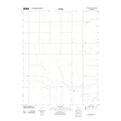
2012 Map of Spearville NW
USGS Topo · Published 2012About this map
Pullers Peak stands as a distinct topographic landmark amidst the expansive drainage basins of northwestern Ford County. This 2012 survey reveals a landscape structured by an orderly grid of section roads, including Antelope Rd and Pole Line Rd, which segment the agricultural terrain. The hydrology is defined by the winding course of Saw Log Cr, joined by smaller tributaries like Duck Cr and Elm Cr. In the northeastern corner, specialized land use is evident near the municipal border, where the Jetmore Municipal Airport and the Jetmore Motorplex signify modern transportation and recreation infrastructure. The map provides a clear view of the rural infrastructure just south of Jetmore, showing how local thoroughfares like Backtrail Rd navigate the low-lying creek beds and occasional elevation changes of the Kansas prairie.
Find a feature on this map
15 named features on this map. Tap any name to fly to it.
Don’t see what you’re looking for? This feature index may not catch every label — zoom into the map to look around manually.
Map Details
Editions of this 2012 Spearville NW Map
This is the sole edition of this map. No revisions or reprints were ever made.
Other maps of this area

1892 · Ness
USGS Topo · 1:125,000

1892 · Dodge
USGS Topo · 1:125,000

1892 · Spearville
USGS Topo · 1:125,000

1894 · Spearville
USGS Topo · 1:125,000

1894 · Ness
USGS Topo · 1:125,000

1955 · Great Bend
USGS Topo · 1:250,000

1955 · Pratt
USGS Topo · 1:250,000

1955 · Dodge City
USGS Topo · 1:250,000

1955 · Scott City
USGS Topo · 1:250,000

1957 · Great Bend
USGS Topo · 1:250,000