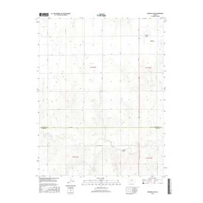
2015 Map of Spearville NW
USGS Topo · Published 2015About this map
Jetmore occupies the northeastern corner of this 2015 study, serving as a focal point where the local road grid converges. The landscape is defined by a rhythmic series of drainage patterns, most notably Saw Log Cr, Duck Cr, and Elm Cr, which carve through the terrain south of the Hodgeman Co Ford Co boundary. A prominent landmark in the southern reaches is Pullers Peak, rising above the surrounding creeks. The map illustrates a highly organized section-line road system, including named routes like Antelope Rd and Duck Creek Rd, which facilitate transport across the rural expanse between the regional center and the Jetmore Municipal Airport. This layout reflects the enduring influence of the Public Land Survey System on the modern Kansas agricultural and transport network.
Find a feature on this map
27 named features on this map. Tap any name to fly to it.
Don’t see what you’re looking for? This feature index may not catch every label — zoom into the map to look around manually.
Map Details
Editions of this 2015 Spearville NW Map
This is the sole edition of this map. No revisions or reprints were ever made.
Other maps of this area

1892 · Ness
USGS Topo · 1:125,000

1892 · Dodge
USGS Topo · 1:125,000

1892 · Spearville
USGS Topo · 1:125,000

1894 · Spearville
USGS Topo · 1:125,000

1894 · Ness
USGS Topo · 1:125,000

1955 · Great Bend
USGS Topo · 1:250,000

1955 · Pratt
USGS Topo · 1:250,000

1955 · Dodge City
USGS Topo · 1:250,000

1955 · Scott City
USGS Topo · 1:250,000

1957 · Great Bend
USGS Topo · 1:250,000