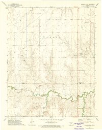
1972 Map of Spearville NW
USGS Topo · Published 1974About this map
Saw Log Creek and its tributaries carve through the plains of western Kansas in this early 1970s survey. The landscape is defined by the historic Fort Dodge Military Reservation Boundary, which cuts across the southern portion of the map, separating the northern reaches from the Grandview area. This boundary once marked the edge of a significant 19th-century military outpost, and its line remained a primary cadastral marker long after the fort's peak activity. Local industry is clearly visible through numerous Oil Wells and a major Pipeline running northwest, alongside several Caliche Pits and gravel operations. To the northeast, the Jetmore Municipal Airport sits on the high ground above Elm Creek, illustrating the intersection of mid-century aviation infrastructure with traditional ranching and oil-rich terrain.
Find a feature on this map
13 named features on this map. Tap any name to fly to it.
Don’t see what you’re looking for? This feature index may not catch every label — zoom into the map to look around manually.
Map Details
Editions of this 1972 Spearville NW Map
This is the sole edition of this map. No revisions or reprints were ever made.
Other maps of this area

1892 · Ness
USGS Topo · 1:125,000

1892 · Dodge
USGS Topo · 1:125,000

1892 · Spearville
USGS Topo · 1:125,000

1894 · Spearville
USGS Topo · 1:125,000

1894 · Ness
USGS Topo · 1:125,000

1955 · Great Bend
USGS Topo · 1:250,000

1955 · Pratt
USGS Topo · 1:250,000

1955 · Dodge City
USGS Topo · 1:250,000

1955 · Scott City
USGS Topo · 1:250,000

1957 · Great Bend
USGS Topo · 1:250,000