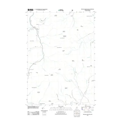
2012 Map of Speckled Mountain
USGS Topo · Published 2012About this map
The settlement of Hastings sits near the confluence of the Wild River and Evans Brook, serving as a gateway to the high peaks of the White Mountain National Forest. This area is defined by sharp topographic relief, including the prominent summit of Speckled Mountain and the strategic passage at Evans Notch. Hikers and outdoorsmen will find points of interest like the White Mountain National Forest Caribou Shelter and Kees Falls on Morrison Brook. The landscape is a network of ridges and watercourses, with Cold River and Stony Brook draining the southern slopes. Notable viewpoints such as the Evans Notch Overlook and Cold River Overlook offer perspectives on the surrounding peaks, while local infrastructure like the Hastings Campground supports recreation in this heavily forested part of Oxford County.
Find a feature on this map
63 named features on this map. Tap any name to fly to it.
Don’t see what you’re looking for? This feature index may not catch every label — zoom into the map to look around manually.
Map Details
Editions of this 2012 Speckled Mountain Map
This is the sole edition of this map. No revisions or reprints were ever made.
Other maps of this area

1893 · Gorham
USGS Topo · 1:62,500

1894 · North Conway
USGS Topo · 1:62,500

1896 · North Conway
USGS Topo · 1:62,500

1896 · Gorham
USGS Topo · 1:62,500

1909 · Fryeburg
USGS Topo · 1:62,500

1911 · Fryeburg
USGS Topo · 1:62,500

1914 · Bethel
USGS Topo · 1:62,500

1937 · Gorham
USGS Topo · 1:48,000

1940 · Bethel
USGS Topo · 1:62,500

1941 · Bethel
USGS Topo · 1:62,500