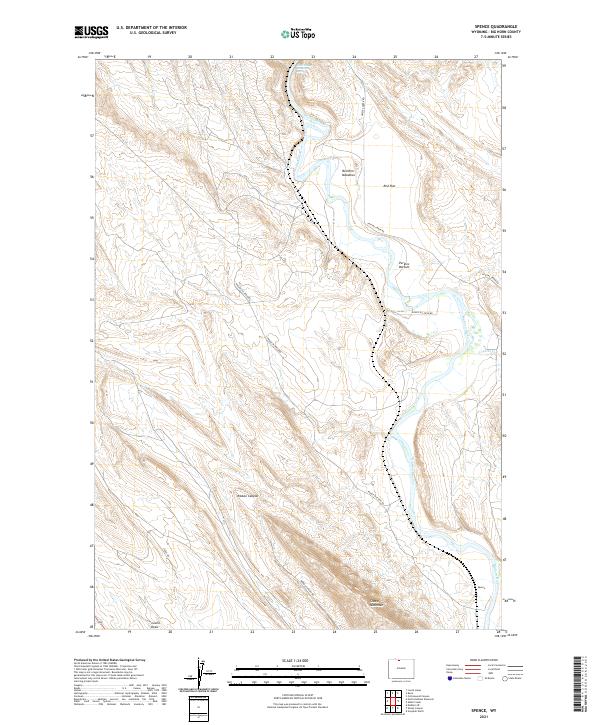
2021 Map of Spence
USGS Topo · Published 2021About this map
Sheep Mountain dominates the southern landscape of this Big Horn County region, where the Bighorn River carves a winding path through the desert terrain. The settlement of Spence sits along the river's edge, serving as a landmark for the industrial and ranching networks that define the area. The map illustrates a complex system of access roads, including Spence Oil Field Rd and Ribbon Canyon Rd, which navigate the elevation changes near Ribbon Canyon.
Find a feature on this map
19 named features on this map. Tap any name to fly to it.
Don’t see what you’re looking for? This feature index may not catch every label — zoom into the map to look around manually.
Map Details
Editions of this 2021 Spence Map
This is the sole edition of this map. No revisions or reprints were ever made.
Other maps of this area

1955 · Cody
USGS Topo · 1:250,000

1958 · Cody
USGS Topo · 1:250,000

1962 · Cody
USGS Topo · 1:250,000

1964 · Kane
USGS Topo · 1:24,000

1964 · Lovell Lakes
USGS Topo · 1:24,000
1966 · Sheep Canyon
USGS Topo · 1:24,000
1966 · Cottonwood Canyon
USGS Topo · 1:24,000

1966 · North Emblem Reservoir
USGS Topo · 1:24,000
1966 · Greybull North
USGS Topo · 1:24,000

1966 · Emblem SE
USGS Topo · 1:24,000