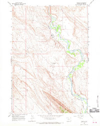
1966 Map of Spence
USGS Topo · Published 1970About this map
The Bighorn River carves a winding path through this mid-1960s landscape, creating fertile lowlands like Red Rim Meadows and Perkins Bottom against the stark rise of Sheep Mountain. The map illustrates the industrial footprint of Big Horn County during this era, centered on the Spence Dome Oil Field and scattered extraction sites such as the Strip Mine in the southern reaches. These operations are linked to the regional economy by the Chicago Burlington and Quincy railroad, which follows the river's course past small railroad-dependent settlements like Himes and Spence. The interplay between the river's drainage and the dry upland terrain is evident in features like Crystal Cr and the deeply etched Ribbon Canyon, showing a territory defined by both its natural geology and its resource extraction history.
Find a feature on this map
17 named features on this map. Tap any name to fly to it.
Don’t see what you’re looking for? This feature index may not catch every label — zoom into the map to look around manually.
Map Details
Editions of this 1966 Spence Map
This is the sole edition of this map. No revisions or reprints were ever made.
Other maps of this area

1955 · Cody
USGS Topo · 1:250,000

1958 · Cody
USGS Topo · 1:250,000

1962 · Cody
USGS Topo · 1:250,000

1964 · Kane
USGS Topo · 1:24,000

1964 · Lovell Lakes
USGS Topo · 1:24,000
1966 · Sheep Canyon
USGS Topo · 1:24,000
1966 · Cottonwood Canyon
USGS Topo · 1:24,000

1966 · North Emblem Reservoir
USGS Topo · 1:24,000
1966 · Greybull North
USGS Topo · 1:24,000

1966 · Emblem SE
USGS Topo · 1:24,000