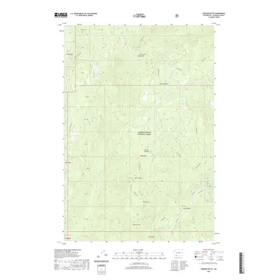
2020 Map of Spencer Butte
USGS Topo · Published 2020About this map
Gifford Pinchot National Forest dominates this Skamania County landscape, where the Lewis River flows past landmarks like Lower Falls and the curiously named Cussed Hollow. The area is defined by high-elevation features including Spencer Butte, Spencer Peak, and Craggy Peak, while seasonal clearings like Spencer Meadow and Wright Meadow break the dense timberline. The Randle-Lewis River corridor provides the primary transit route through this terrain, connecting various public land tracts and surveying sections. The mapping of Snyder Pasture and several unnamed bluff points suggests a history of livestock grazing and early forest management within the national forest boundaries. This 2020 record captures the modern topographical state of the Southern Cascades, reflecting the established network of forest roads and the preservation of watershed systems such as Elk Cr and Clear Cr.
Find a feature on this map
31 named features on this map. Tap any name to fly to it.
Don’t see what you’re looking for? This feature index may not catch every label — zoom into the map to look around manually.
Map Details
Editions of this 2020 Spencer Butte Map
This is the sole edition of this map. No revisions or reprints were ever made.
Other maps of this area

1919 · Mount St Helens
USGS Topo · 1:125,000

1926 · Steamboat Mtn
USGS Topo · 1:125,000

1931 · Steamboat Mtn
USGS Topo · 1:125,000

1950 · Yakima
USGS Topo · 1:250,000

1953 · Hoquiam
USGS Topo · 1:250,000

1957 · Hoquiam
USGS Topo · 1:250,000

1957 · Spirit Lake
USGS Topo · 1:62,500

1958 · Mt St. Helens
USGS Topo · 1:62,500

1958 · Yakima
USGS Topo · 1:250,000

1958 · Hoquiam
USGS Topo · 1:250,000