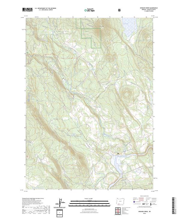
2024 Map of Spencer Creek
USGS Topo · Published 2024About this map
Winema National Forest dominates the northern reaches of this Klamath County landscape, where the Grampian Hills and Clover Butte define the high country. Water management is a primary theme of the terrain, with the Klamath River flowing through the southern portion of the quadrangle. Significant infrastructure for water storage is evident at the John C Boyle Reservoir, alongside smaller impoundments like Grub Spring Reservoir and Camp Three Reservoir. This network of reservoirs and creeks, including Clover Creek and Spencer Creek, suggests a landscape heavily shaped by hydroelectric and agricultural water needs. Historically minded researchers will note the Spencer Cem positioned north of the river, while the presence of Topsy Grade Rd and Slip Easy Rd hints at the area's logging and ranching transportation history.
Find a feature on this map
33 named features on this map. Tap any name to fly to it.
Don’t see what you’re looking for? This feature index may not catch every label — zoom into the map to look around manually.
Map Details
Editions of this 2024 Spencer Creek Map
This is the sole edition of this map. No revisions or reprints were ever made.
Other maps of this area

1889 · Klamath
USGS Topo · 1:250,000

1891 · Ashland
USGS Topo · 1:250,000

1893 · Ashland
USGS Topo · 1:250,000

1894 · Klamath
USGS Topo · 1:250,000

1897 · Ashland
USGS Topo · 1:250,000

1955 · Lake O' Woods
USGS Topo · 1:62,500

1955 · Surveyor Mtn
USGS Topo · 1:62,500

1955 · Klamath Falls
USGS Topo · 1:250,000

1955 · Medford
USGS Topo · 1:250,000

1957 · Medford
USGS Topo · 1:250,000