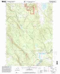
1998 Map of Spencer Creek
USGS Topo · Published 2000About this map
Winema National Forest encompasses much of this landscape in southern Oregon, where the timber industry and water management have long defined the local economy. The Lumber Railroad winds through the central hills, illustrating the logistical complexity of harvesting timber near Clover Creek and Spencer Creek. To the southeast, the Klamath River flows into the John C Boyle Reservoir, a critical hub for recreation and power as evidenced by the John C Boyle Picnic Area and the Topsy Campground. These developments, alongside features like the Grub Spring Reservoir and Camp 3 Res, show a transition from early wilderness tracks such as Walters Cabin Road to a more industrial and managed river-and-rail network in the late twentieth century.
Find a feature on this map
30 named features on this map. Tap any name to fly to it.
Don’t see what you’re looking for? This feature index may not catch every label — zoom into the map to look around manually.
Map Details
Editions of this 1998 Spencer Creek Map
This is the sole edition of this map. No revisions or reprints were ever made.
Other maps of this area

1889 · Klamath
USGS Topo · 1:250,000

1891 · Ashland
USGS Topo · 1:250,000

1893 · Ashland
USGS Topo · 1:250,000

1894 · Klamath
USGS Topo · 1:250,000

1897 · Ashland
USGS Topo · 1:250,000

1955 · Lake O' Woods
USGS Topo · 1:62,500

1955 · Surveyor Mtn
USGS Topo · 1:62,500

1955 · Klamath Falls
USGS Topo · 1:250,000

1955 · Medford
USGS Topo · 1:250,000

1957 · Medford
USGS Topo · 1:250,000