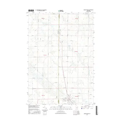
2015 Map of Spencer North
USGS Topo · Published 2015About this map
The village of Spencer and the community of Unity anchor this landscape along the border of Marathon and Clark Counties. The terrain is defined by its complex hydrology, dominated by the Little Eau Pleine River and its associated wetlands, including Spencer Marsh and McMillan Marsh. This area is marked by a traditional grid of agricultural roads, such as Townhall Rd and Fairhaven Ave, which connect the rural farmsteads to the central transport corridors of Front St and River Ave.
Find a feature on this map
78 named features on this map. Tap any name to fly to it.
Don’t see what you’re looking for? This feature index may not catch every label — zoom into the map to look around manually.
Map Details
Editions of this 2015 Spencer North Map
This is the sole edition of this map. No revisions or reprints were ever made.
Other maps of this area

1902 · Marathon
USGS Topo · 1:125,000

1953 · Abbotsford
USGS Topo · 1:48,000

1953 · Stratford
USGS Topo · 1:48,000

1953 · Eau Claire
USGS Topo · 1:250,000

1954 · Granton
USGS Topo · 1:62,500

1954 · Marshfield
USGS Topo · 1:62,500

1958 · Eau Claire
USGS Topo · 1:250,000

1963 · Stratford
USGS Topo · 1:62,500

1963 · Abbotsford
USGS Topo · 1:62,500

1964 · Eau Claire
USGS Topo · 1:250,000