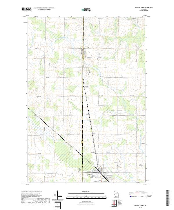
2022 Map of Spencer North
USGS Topo · Published 2022About this map
The Clark and Marathon County line bisects this portion of Wisconsin, defining the local geography as it moves through agricultural lands and wetlands. The village of Unity sits at the northern edge of the sheet, while the northern residential streets of another community emerge in the south along W Main St and W Clark St. This area is characterized by its numerous small burial grounds, including the Brighton Municipal Cem near the county line and the West Spencer Cem further south.
Find a feature on this map
56 named features on this map. Tap any name to fly to it.
Don’t see what you’re looking for? This feature index may not catch every label — zoom into the map to look around manually.
Map Details
Editions of this 2022 Spencer North Map
This is the sole edition of this map. No revisions or reprints were ever made.
Other maps of this area

1902 · Marathon
USGS Topo · 1:125,000

1953 · Abbotsford
USGS Topo · 1:48,000

1953 · Stratford
USGS Topo · 1:48,000

1953 · Eau Claire
USGS Topo · 1:250,000

1954 · Granton
USGS Topo · 1:62,500

1954 · Marshfield
USGS Topo · 1:62,500

1958 · Eau Claire
USGS Topo · 1:250,000

1963 · Stratford
USGS Topo · 1:62,500

1963 · Abbotsford
USGS Topo · 1:62,500

1964 · Eau Claire
USGS Topo · 1:250,000