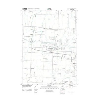
2013 Map of Spencerport
USGS Topo · Published 2013About this map
Spencerport and its surroundings in western Monroe County are defined by the path of the Erie Canal, which cuts through the village and past Adams Basin. This modern landscape retains many ties to its agricultural roots, evidenced by family-named properties like Mariah Meadows Farm and Colby Homestead Farms. The region is punctuated by numerous small burial grounds and pioneer sites, including the Castle Family Pioneer Cem and Hoosic Hill Pioneer Cem, which serve as vital markers for local genealogy. The transition from industrial canal traffic to local aviation is visible through landmarks such as Spencerport Airpark and the Manitou Field Airport. Small communities and crossroad settlements like Hinkleyville and Parma Corners remain distinct nodes amidst the suburban growth, while natural drainage like Buttonwood Cr and Northrup Cr continue to shape the terrain between the canal and the Lake Ontario plain.
Find a feature on this map
167 named features on this map. Tap any name to fly to it.
Don’t see what you’re looking for? This feature index may not catch every label — zoom into the map to look around manually.
Map Details
Editions of this 2013 Spencerport Map
This is the sole edition of this map. No revisions or reprints were ever made.
Other maps of this area

1895 · Rochester
USGS Topo · 1:62,500

1895 · Ontario Beach
USGS Topo · 1:62,500

1898 · Rochester
USGS Topo · 1:62,500

1899 · Hamlin
USGS Topo · 1:62,500

1899 · Ontario Beach
USGS Topo · 1:62,500

1899 · Brockport
USGS Topo · 1:62,500

1912 · Rochester
USGS Topo · 1:62,500

1912 · Ontario Beach
USGS Topo · 1:62,500

1920 · Rochester
USGS Topo · 1:62,500

1931 · Rochester West
USGS Topo · 1:24,000