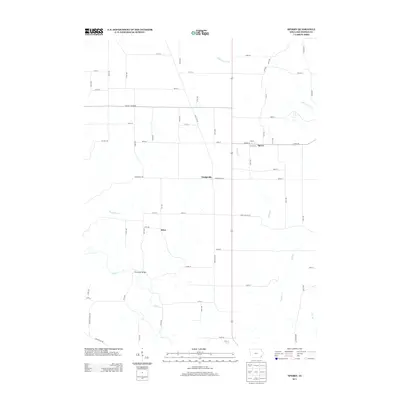
2013 Map of Sperry
USGS Topo · Published 2013About this map
Sperry and Dodgeville anchor this portion of Des Moines County, where the agricultural landscape is deeply etched by a network of local waterways. The southern reaches are defined by the winding course of Flint Cr, where the Flint River Bridge serves as a critical crossing point. Further north, the terrain is drained by numerous streams including Yellow Spring Cr, Knotty Cr, and Big Hollow Cr, reflecting the natural drainage patterns that have historically shaped farm boundaries and road placements in this corner of Iowa. The map documents the grid-based road system, including named routes like Dodgeville Rd and Pleasant Grove Rd, which connect the small settlements of the interior. This survey provides a precise look at the rural geography and transport infrastructure just west of the Mississippi River corridor during the early 21st century.
Find a feature on this map
60 named features on this map. Tap any name to fly to it.
Don’t see what you’re looking for? This feature index may not catch every label — zoom into the map to look around manually.
Map Details
Editions of this 2013 Sperry Map
This is the sole edition of this map. No revisions or reprints were ever made.
Other maps of this area

1934 · Burlington
USGS Topo · 1:48,000

1940 · Burlington
USGS Topo · 1:62,500

1946 · Wapello
USGS Topo · 1:62,500

1949 · Wapello
USGS Topo · 1:62,500

1958 · Burlington
USGS Topo · 1:250,000

1958 · Davenport
USGS Topo · 1:250,000

1961 · Burlington
USGS Topo · 1:250,000

1961 · Davenport
USGS Topo · 1:250,000

1962 · Davenport
USGS Topo · 1:250,000

1963 · Burlington
USGS Topo · 1:250,000