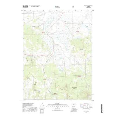
2019 Map of Spicer Peak
USGS Topo · Published 2019About this map
Continental Divide National Scenic Trail winds through a high-altitude landscape defined by complex irrigation systems and steep mountain peaks. The divide itself serves as a natural and political boundary, including the line for Grand Co Jackson Co near Ironclad Mtn. The reliance on water management in this high country is evident in the dense network of ditches, such as Mexican Ditch, Arapaho Ditch, and Eureka Ditch, which redirect flow from glacial creeks into reservoirs like Hecla Reservoir and South Arapaho Reservoir. Within the Routt National Forest and Arapaho National Forest, the topography shifts from the flats of Mexican Ridge to the prominent heights of Spicer Peak and the Rabbit Ears Range. These peaks and passes, including Arapaho Pass, highlight the terrain that has historically challenged travelers through the northern Colorado mountains.
Find a feature on this map
51 named features on this map. Tap any name to fly to it.
Don’t see what you’re looking for? This feature index may not catch every label — zoom into the map to look around manually.
Map Details
Editions of this 2019 Spicer Peak Map
This is the sole edition of this map. No revisions or reprints were ever made.
Other maps of this area

1911 · Hahns Peak
USGS Topo · 1:125,000

1913 · Hahns Peak
USGS Topo · 1:125,000

1954 · Craig
USGS Topo · 1:250,000

1955 · Teal Lake
USGS Topo · 1:24,000

1955 · Coalmont
USGS Topo · 1:24,000

1955 · Mac Farlane Reservoir
USGS Topo · 1:24,000

1955 · Mount Ethel
USGS Topo · 1:62,500

1955 · Walden
USGS Topo · 1:62,500

1956 · Rabbit Ears Peak
USGS Topo · 1:24,000

1956 · Lake Agnes
USGS Topo · 1:24,000