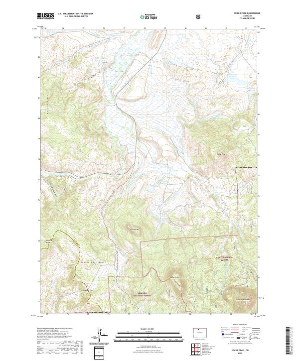
2022 Map of Spicer Peak
USGS Topo · Published 2022About this map
The Continental Divide National Scenic Trl winds along the boundary of Jackson Co Grand Co in this high-altitude landscape. This region of the Rabbit Ears Range is defined by a sophisticated network of water management features, including the Arapaho Ditch, Titanic Ditch, and Lawrence Number 1 Ditch. These man-made channels divert water across the drainage divides of Mexican Cr and Grizzly Cr, supporting localized reservoirs like South Arapaho Reservoir and Coute Reservoir. The terrain is characterized by prominent peaks and ridges such as Spicer Peak and Ironclad Mtn (9300), while low-lying areas like Ed Van Draw and Horseshoe Bend Draw channel the seasonal flow. The proximity of the Arapaho National Forest and Routt National Forest highlights the area's role as a protected watershed and recreational corridor.
Find a feature on this map
52 named features on this map. Tap any name to fly to it.
Don’t see what you’re looking for? This feature index may not catch every label — zoom into the map to look around manually.
Map Details
Editions of this 2022 Spicer Peak Map
This is the sole edition of this map. No revisions or reprints were ever made.
Other maps of this area

1911 · Hahns Peak
USGS Topo · 1:125,000

1913 · Hahns Peak
USGS Topo · 1:125,000

1954 · Craig
USGS Topo · 1:250,000

1955 · Teal Lake
USGS Topo · 1:24,000

1955 · Coalmont
USGS Topo · 1:24,000

1955 · Mac Farlane Reservoir
USGS Topo · 1:24,000

1955 · Mount Ethel
USGS Topo · 1:62,500

1955 · Walden
USGS Topo · 1:62,500

1956 · Rabbit Ears Peak
USGS Topo · 1:24,000

1956 · Lake Agnes
USGS Topo · 1:24,000