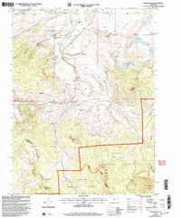
2000 Map of Spicer Peak
USGS Topo · Published 2004About this map
Spicer serves as a central point in this high-altitude landscape where the Continental Divide and Rabbit Ears Range shape the local geography. The map reveals a complex system of water management critical to ranching in the Arapaho National Forest, with numerous named ditches like the Koping Ditch, Seymour No 2 Ditch, and Jordan Ditch feeding into reservoirs such as Mexican Reservoir and Hecla Reservoir. This infrastructure supports a network of family-held operations, including the Van Valkenburg Ranch, several holdings by the Murphy family, and the Bailey Ranch. Prominent peaks like Ironclad Mountain and Spicer Peak dominate the skyline, while high passes such as Arapaho Pass provide transit across the county line between Jackson and Grand counties.
Find a feature on this map
46 named features on this map. Tap any name to fly to it.
Don’t see what you’re looking for? This feature index may not catch every label — zoom into the map to look around manually.
Map Details
Editions of this 2000 Spicer Peak Map
This is the sole edition of this map. No revisions or reprints were ever made.
Other maps of this area

1911 · Hahns Peak
USGS Topo · 1:125,000

1913 · Hahns Peak
USGS Topo · 1:125,000

1954 · Craig
USGS Topo · 1:250,000

1955 · Teal Lake
USGS Topo · 1:24,000

1955 · Coalmont
USGS Topo · 1:24,000

1955 · Mac Farlane Reservoir
USGS Topo · 1:24,000

1955 · Mount Ethel
USGS Topo · 1:62,500

1955 · Walden
USGS Topo · 1:62,500

1956 · Rabbit Ears Peak
USGS Topo · 1:24,000

1956 · Lake Agnes
USGS Topo · 1:24,000