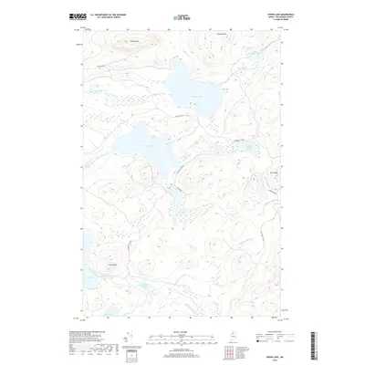
2018 Map of Spider Lake
USGS Topo · Published 2018About this map
Spider Lake and Pleasant Lake form the central hydrological focus of this North Woods territory in Piscataquis County, Maine. The landscape is defined by its complex network of interconnected ponds and streams, which historically served as vital corridors for the region's timber industry. A series of forest management roads, including Churchill Dam Rd and Haymock Rd, trace the lowlands between significant topographic rises like Harrow Mtn and Pleasant Mtn. To the south and east, the terrain becomes more pronounced along Cliff Ridge and Echo Ridge, overlooking isolated water bodies such as Cliff Lake and Upper Soper Pond. This area remains characterized by its remote character and the prevalence of expansive wetlands and bogs, evidenced by the numerous unnamed marsh symbols surrounding Grass Pond and Upper Portage Pond.
Find a feature on this map
23 named features on this map. Tap any name to fly to it.
Don’t see what you’re looking for? This feature index may not catch every label — zoom into the map to look around manually.
Map Details
Editions of this 2018 Spider Lake Map
This is the sole edition of this map. No revisions or reprints were ever made.
Other maps of this area

1932 · Umsaskis Lake
USGS Topo · 1:48,000

1932 · Musquacook Lakes
USGS Topo · 1:48,000

1935 · Umsaskis Lake
USGS Topo · 1:62,500

1935 · Musquacook Lakes
USGS Topo · 1:62,500

1954 · Spider Lake
USGS Topo · 1:62,500

1954 · Churchill Lake
USGS Topo · 1:62,500

1954 · Presque Isle
USGS Topo · 1:250,000

1958 · Presque Isle
USGS Topo · 1:250,000

1960 · Presque Isle
USGS Topo · 1:250,000

1961 · Spider Lake
USGS Topo · 1:62,500