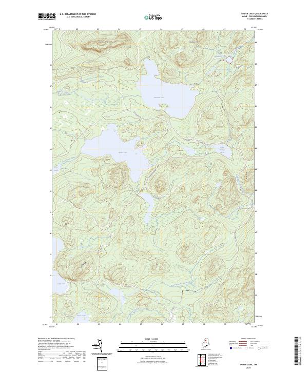
2024 Map of Spider Lake
USGS Topo · Published 2024About this map
Spider Lake and the interconnected waters of the Maine North Woods dominate this wilderness area in Piscataquis County. The landscape is characterized by a complex network of glacial ponds and streams, including the prominent Pleasant Lake and the smaller Cliff Lake tucked beneath the heights of Cliff Ridge. The terrain rises toward the north and east at Harrow Mtn and Pleasant Mtn, providing the high ground for drainage systems like Pleasant Stream and North Branch Echo-Brook. This recent survey illustrates a remote region accessed primarily by logging and forest management routes such as Church Dam Rd and Churchill Dam Rd. The geography suggests a legacy of traditional Maine water routes and timber harvesting, where the naming of Upper Portage Pond points to historic carries between these isolated water bodies.
Find a feature on this map
22 named features on this map. Tap any name to fly to it.
Don’t see what you’re looking for? This feature index may not catch every label — zoom into the map to look around manually.
Map Details
Editions of this 2024 Spider Lake Map
This is the sole edition of this map. No revisions or reprints were ever made.
Other maps of this area

1932 · Umsaskis Lake
USGS Topo · 1:48,000

1932 · Musquacook Lakes
USGS Topo · 1:48,000

1935 · Umsaskis Lake
USGS Topo · 1:62,500

1935 · Musquacook Lakes
USGS Topo · 1:62,500

1954 · Spider Lake
USGS Topo · 1:62,500

1954 · Churchill Lake
USGS Topo · 1:62,500

1954 · Presque Isle
USGS Topo · 1:250,000

1958 · Presque Isle
USGS Topo · 1:250,000

1960 · Presque Isle
USGS Topo · 1:250,000

1961 · Spider Lake
USGS Topo · 1:62,500