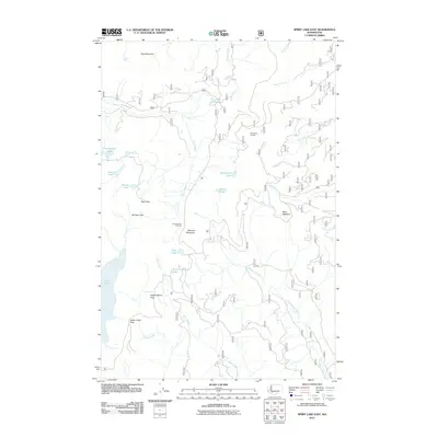
2011 Map of Spirit Lake East
USGS Topo · Published 2011About this map
Goat Mountain and Bismark Mountain dominate this high-elevation landscape in Skamania County, where the 2011 terrain is defined by dramatic ridgelines and alpine hydrology. The map illustrates a dense network of water bodies, including Spirit Lake, Saint Charles Lake, and Grizzly Lake, along with the once-famous Harmony Falls. The area's recreational and navigational layout is centered on locations like Norway Pass Trailhead, providing access to critical viewpoints such as Strawberry Lookout and Bear Meadow. The drainage patterns are clearly delineated through the paths of Clearwater Creek, Smith Creek, and the Green River, which carve through the mountain passes. This survey serves as a vital record of the land following significant volcanic activity in the late 20th century, showing the recovery of forest service roads and the established trail system through Independence Pass and Norway Pass.
Find a feature on this map
29 named features on this map. Tap any name to fly to it.
Don’t see what you’re looking for? This feature index may not catch every label — zoom into the map to look around manually.
Map Details
Editions of this 2011 Spirit Lake East Map
This is the sole edition of this map. No revisions or reprints were ever made.
Other maps of this area

1919 · Mount St Helens
USGS Topo · 1:125,000

1926 · Steamboat Mtn
USGS Topo · 1:125,000

1931 · Steamboat Mtn
USGS Topo · 1:125,000

1950 · Yakima
USGS Topo · 1:250,000

1953 · Hoquiam
USGS Topo · 1:250,000

1957 · Hoquiam
USGS Topo · 1:250,000

1957 · Spirit Lake
USGS Topo · 1:62,500

1958 · Mt St. Helens
USGS Topo · 1:62,500

1958 · Yakima
USGS Topo · 1:250,000

1958 · Hoquiam
USGS Topo · 1:250,000