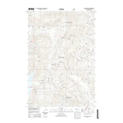
2013 Map of Spirit Lake East
USGS Topo · Published 2013About this map
Gifford Pinchot National Forest dominates this topographic survey, revealing the complex drainage systems and volcanic terrain of the South Cascades decades after the 1980 eruption. The northeastern edge of Spirit Lake is visible, along with a network of high-elevation water bodies such as Saint Charles Lake, Grizzly Lake, and Panhandle Lake. These alpine lakes are connected by a landscape of sharp ridges and passes, including Windy Ridge, Norway Pass, and Independence Pass.
Find a feature on this map
42 named features on this map. Tap any name to fly to it.
Don’t see what you’re looking for? This feature index may not catch every label — zoom into the map to look around manually.
Map Details
Editions of this 2013 Spirit Lake East Map
This is the sole edition of this map. No revisions or reprints were ever made.
Other maps of this area

1919 · Mount St Helens
USGS Topo · 1:125,000

1926 · Steamboat Mtn
USGS Topo · 1:125,000

1931 · Steamboat Mtn
USGS Topo · 1:125,000

1950 · Yakima
USGS Topo · 1:250,000

1953 · Hoquiam
USGS Topo · 1:250,000

1957 · Hoquiam
USGS Topo · 1:250,000

1957 · Spirit Lake
USGS Topo · 1:62,500

1958 · Mt St. Helens
USGS Topo · 1:62,500

1958 · Yakima
USGS Topo · 1:250,000

1958 · Hoquiam
USGS Topo · 1:250,000