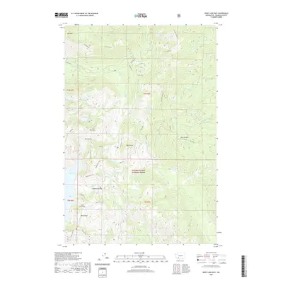
2020 Map of Spirit Lake East
USGS Topo · Published 2020About this map
Gifford Pinchot National Forest dominates this landscape northeast of Spirit Lake, where the topography is defined by sharp ridges and a dense network of mountain lakes. The map details the complex drainage systems of the Green River, Clearwater Cr, and Smith Creek, illustrating the drainage patterns in the shadow of Goat Mtn and Bismark Mtn. Notable high-altitude crossings like Norway Pass and Independence Pass connect the varying elevations, while Windy Ridge provides a prominent vantage point over the southern portion of the quadrangle.
Find a feature on this map
40 named features on this map. Tap any name to fly to it.
Don’t see what you’re looking for? This feature index may not catch every label — zoom into the map to look around manually.
Map Details
Editions of this 2020 Spirit Lake East Map
This is the sole edition of this map. No revisions or reprints were ever made.
Other maps of this area

1919 · Mount St Helens
USGS Topo · 1:125,000

1926 · Steamboat Mtn
USGS Topo · 1:125,000

1931 · Steamboat Mtn
USGS Topo · 1:125,000

1950 · Yakima
USGS Topo · 1:250,000

1953 · Hoquiam
USGS Topo · 1:250,000

1957 · Hoquiam
USGS Topo · 1:250,000

1957 · Spirit Lake
USGS Topo · 1:62,500

1958 · Mt St. Helens
USGS Topo · 1:62,500

1958 · Yakima
USGS Topo · 1:250,000

1958 · Hoquiam
USGS Topo · 1:250,000