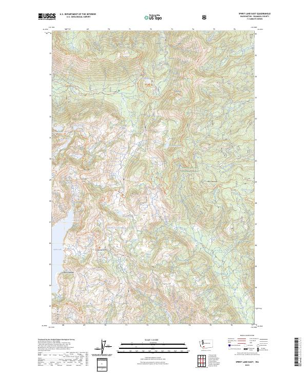
2023 Map of Spirit Lake East
USGS Topo · Published 2023About this map
Mount Saint Helens National Volcanic Monument defines this landscape, where the recovery of a volcanic ecosystem is meticulously documented. The map centers on the eastern shores of Spirit Lake, a site of profound geological change. High-elevation points like Bismark Mtn and Goat Mtn overlook a complex network of alpine waters, including Ghost Lake, Strawberry Lake, and Panhandle Lake. The terrain is marked by significant passages such as Norway Pass and Independence Pass, which serve as vital connectors for researchers and hikers traversing the Gifford Pinchot National Forest. A dense system of trails, including the Green River Trl and Smith Creek Trl, illustrates the accessibility of this protected wilderness. Notable landmarks like Harmony Falls and Windy Ridge provide specific points of reference for studying the long-term environmental shifts within the blast zone and its surrounding forests.
Find a feature on this map
47 named features on this map. Tap any name to fly to it.
Don’t see what you’re looking for? This feature index may not catch every label — zoom into the map to look around manually.
Map Details
Editions of this 2023 Spirit Lake East Map
This is the sole edition of this map. No revisions or reprints were ever made.
Other maps of this area

1919 · Mount St Helens
USGS Topo · 1:125,000

1926 · Steamboat Mtn
USGS Topo · 1:125,000

1931 · Steamboat Mtn
USGS Topo · 1:125,000

1950 · Yakima
USGS Topo · 1:250,000

1953 · Hoquiam
USGS Topo · 1:250,000

1957 · Hoquiam
USGS Topo · 1:250,000

1957 · Spirit Lake
USGS Topo · 1:62,500

1958 · Mt St. Helens
USGS Topo · 1:62,500

1958 · Yakima
USGS Topo · 1:250,000

1958 · Hoquiam
USGS Topo · 1:250,000