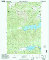
1996 Map of Spirit Lake West
USGS Topo · Published 1999About this map
Spirit Lake and the northern reaches of Twin Lakes anchor this landscape within the Kaniksu National Forest. The map documents the mid-1990s development of the shoreline, featuring established recreational points such as Silver Beach, Silver Sands Beach, Echo Beach, and Excelsior Beach. Steep drainages like Brickel Creek and Brickel Creek flow from the surrounding peaks of the Selkirk Mountains, including Larch Mountain and Pitz Mountain.
Find a feature on this map
35 named features on this map. Tap any name to fly to it.
Don’t see what you’re looking for? This feature index may not catch every label — zoom into the map to look around manually.
Map Details
Editions of this 1996 Spirit Lake West Map
This is the sole edition of this map. No revisions or reprints were ever made.
Other maps of this area

1901 · Sandpoint
USGS Topo · 1:125,000

1901 · Spokane
USGS Topo · 1:125,000

1903 · Rathdrum
USGS Topo · 1:125,000

1911 · Priest Lake
USGS Topo · 1:250,000

1911 · Sandpoint
USGS Topo · 1:125,000

1913 · Priest Lake
USGS Topo · 1:250,000

1936 · Newport
USGS Topo · 1:96,000

1942 · Newport
USGS Topo · 1:125,000

1943 · Mt Spokane
USGS Topo · 1:62,500

1950 · Mt Spokane
USGS Topo · 1:62,500