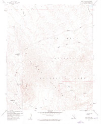
1959 Map of Spirit Mtn
USGS Topo · Published 1960About this map
The Newberry Mountains dominate this 1959 survey, revealing a landscape defined by high peaks and an active history of mineral exploration. Mining activity is evident throughout the terrain, with operations such as the Goldenrod Mine, Empire Mine, White Rock Mine, and Roman Mine scattered among the high ridges. The map identifies the small settlement of Camp Thurman, situated near the Potential Mine and a local Uslm survey monument, providing a look at mid-century habitations in the Nevada desert.
Find a feature on this map
26 named features on this map. Tap any name to fly to it.
Don’t see what you’re looking for? This feature index may not catch every label — zoom into the map to look around manually.
Map Details
Editions of this 1959 Spirit Mtn Map
4 editions found
Other maps of this area

1886 · Camp Mohave
USGS Topo · 1:250,000

1892 · Camp Mohave
USGS Topo · 1:250,000

1926 · Mohave City
USGS Topo · 1:96,000

1942 · Camp Mohave
USGS Topo · 1:250,000

1947 · Kingman
USGS Topo · 1:250,000

1948 · Kingman
USGS Topo · 1:250,000

1950 · Davis Dam
USGS Topo · 1:62,500

1952 · Davis Dam
USGS Topo · 1:62,500

1954 · Kingman
USGS Topo · 1:250,000

1955 · Kingman
USGS Topo · 1:250,000