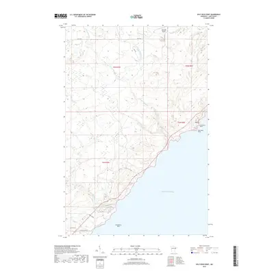
2019 Map of Split Rock Point
USGS Topo · Published 2019About this map
Lake Superior dominates the eastern edge of this landscape, where the dramatic North Shore meets the water at Split Rock Point and Corundum Point. The terrain is defined by the complex drainage systems of the W Split Rock River and E Split Rock River, which descend through a series of ridges and valleys toward the lake. Inland, the presence of the Silver Bay Municipal Airport and a network of local routes like S Hester Grade and E Castle Danger Rd show the modern infrastructure layered over this wilderness character.
Find a feature on this map
26 named features on this map. Tap any name to fly to it.
Don’t see what you’re looking for? This feature index may not catch every label — zoom into the map to look around manually.
Map Details
Editions of this 2019 Split Rock Point Map
This is the sole edition of this map. No revisions or reprints were ever made.
Other maps of this area

1953 · Whyte
USGS Topo · 1:62,500

1954 · Silver Bay
USGS Topo · 1:62,500

1954 · Two Harbors
USGS Topo · 1:250,000

1956 · Split Rock Point
USGS Topo · 1:24,000

1956 · Split Rock Point
USGS Topo · 1:62,500

1956 · Split Rock Point NE
USGS Topo · 1:24,000

1957 · Two Harbors
USGS Topo · 1:250,000

1957 · Two Harbors
USGS Topo · 1:62,500

1957 · Two Harbors NE
USGS Topo · 1:24,000

1957 · Castle Danger
USGS Topo · 1:24,000