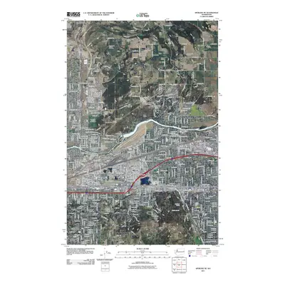
2011 Map of Spokane NE
USGS Topo · Published 2011About this map
Felts Field and the Spokane River corridor anchor this geographic study of northeast Spokane, where urban development meets the agricultural reaches of Orchard Prairie. The map documents a complex landscape of water management and transportation, featuring the Upriver Dam and the industrial infrastructure of Yardley and Parkwater. This 2011 edition shows the established residential patterns of Millwood and Pasadena Park alongside significant institutional landmarks like the Hutton Settlement and Mount Saint Michael Cemetery.
Find a feature on this map
277 named features on this map. Tap any name to fly to it.
Don’t see what you’re looking for? This feature index may not catch every label — zoom into the map to look around manually.
Map Details
Editions of this 2011 Spokane NE Map
This is the sole edition of this map. No revisions or reprints were ever made.
Other maps of this area

1901 · Spokane
USGS Topo · 1:125,000

1943 · Mt Spokane
USGS Topo · 1:62,500

1949 · Deer Park
USGS Topo · 1:62,500

1949 · Greenacres
USGS Topo · 1:62,500

1950 · Spokane NE
USGS Topo · 1:24,000

1950 · Spokane SE
USGS Topo · 1:24,000

1950 · Mt Spokane
USGS Topo · 1:62,500

1950 · Spokane SW
USGS Topo · 1:24,000

1950 · Spokane NW
USGS Topo · 1:24,000

1950 · Spokane
USGS Topo · 1:62,500