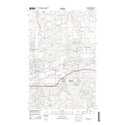
2014 Map of Spokane NE
USGS Topo · Published 2014About this map
The Spokane River corridor serves as the industrial and transportation backbone of this region, where the BNSF Railway and major thoroughfares connect the eastern suburbs with the city's heart. Dense urban residential grids in Spokane and Spokane Valley give way to the more open, upland character of Orchard Prairie and Pleasant Prairie. This transition between the bustling river valley and the northern prairies is marked by a series of long-established burial grounds, including Evergreen Cem and Michael Cem.
Find a feature on this map
162 named features on this map. Tap any name to fly to it.
Don’t see what you’re looking for? This feature index may not catch every label — zoom into the map to look around manually.
Map Details
Editions of this 2014 Spokane NE Map
This is the sole edition of this map. No revisions or reprints were ever made.
Other maps of this area

1901 · Spokane
USGS Topo · 1:125,000

1943 · Mt Spokane
USGS Topo · 1:62,500

1949 · Deer Park
USGS Topo · 1:62,500

1949 · Greenacres
USGS Topo · 1:62,500

1950 · Spokane NE
USGS Topo · 1:24,000

1950 · Spokane SE
USGS Topo · 1:24,000

1950 · Mt Spokane
USGS Topo · 1:62,500

1950 · Spokane SW
USGS Topo · 1:24,000

1950 · Spokane NW
USGS Topo · 1:24,000

1950 · Spokane
USGS Topo · 1:62,500