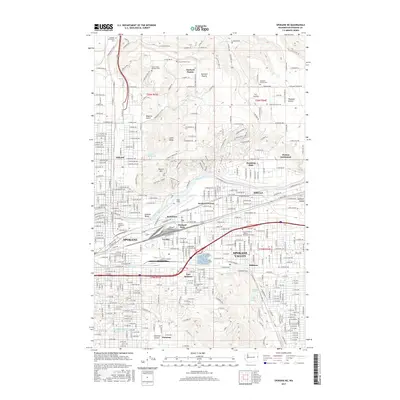
2017 Map of Spokane NE
USGS Topo · Published 2017About this map
The Spokane River serves as the central artery for this industrial and residential landscape, flanked by the sprawling rail infrastructure of the BNSF Railway. This 2017 survey highlights the dense urban development of Spokane and Spokane Valley, while preserving the distinct identity of older neighborhoods like Hillyard and Millwood. Aviation history is prominent at Felts Field, an airfield established along the river's southern bank, adjacent to the industrial hubs of Parkwater and Yardley.
Find a feature on this map
159 named features on this map. Tap any name to fly to it.
Don’t see what you’re looking for? This feature index may not catch every label — zoom into the map to look around manually.
Map Details
Editions of this 2017 Spokane NE Map
This is the sole edition of this map. No revisions or reprints were ever made.
Other maps of this area

1901 · Spokane
USGS Topo · 1:125,000

1943 · Mt Spokane
USGS Topo · 1:62,500

1949 · Deer Park
USGS Topo · 1:62,500

1949 · Greenacres
USGS Topo · 1:62,500

1950 · Spokane NE
USGS Topo · 1:24,000

1950 · Spokane SE
USGS Topo · 1:24,000

1950 · Mt Spokane
USGS Topo · 1:62,500

1950 · Spokane SW
USGS Topo · 1:24,000

1950 · Spokane NW
USGS Topo · 1:24,000

1950 · Spokane
USGS Topo · 1:62,500