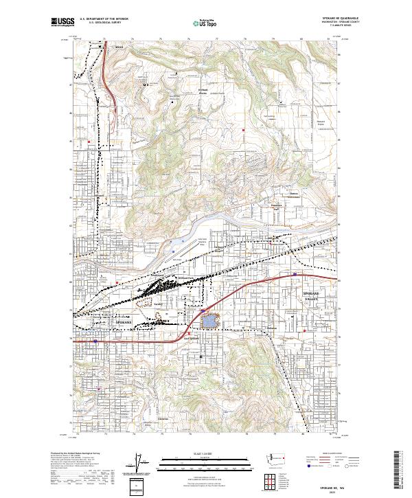
2023 Map of Spokane NE
USGS Topo · Published 2023About this map
The Spokane River carves through this detailed survey, defining the industrial and residential corridors of the northeast metropolitan area. Aviation history is central to this landscape, anchored by Felts Field and the Felts Field Seaplane Base on the river’s southern bank. The map reveals the transition from the dense urban grid of Spokane and Spokane Valley to the elevated plateaus of Orchard Prairie and Pleasant Prairie. This geographic shift is marked by numerous historic burial sites, including the Jesuit Cem of the Oregon Province and the Saint Michaels Mission Cem, reflecting the early religious foundations of the region. Between the valley floor at Millwood and the heights of Glenrose Prairie, the landscape is a complex network of established neighborhoods and the expanding infrastructure of East Spokane.
Find a feature on this map
181 named features on this map. Tap any name to fly to it.
Don’t see what you’re looking for? This feature index may not catch every label — zoom into the map to look around manually.
Map Details
Editions of this 2023 Spokane NE Map
This is the sole edition of this map. No revisions or reprints were ever made.
Other maps of this area

1901 · Spokane
USGS Topo · 1:125,000

1943 · Mt Spokane
USGS Topo · 1:62,500

1949 · Deer Park
USGS Topo · 1:62,500

1949 · Greenacres
USGS Topo · 1:62,500

1950 · Spokane NE
USGS Topo · 1:24,000

1950 · Spokane SE
USGS Topo · 1:24,000

1950 · Mt Spokane
USGS Topo · 1:62,500

1950 · Spokane SW
USGS Topo · 1:24,000

1950 · Spokane NW
USGS Topo · 1:24,000

1950 · Spokane
USGS Topo · 1:62,500