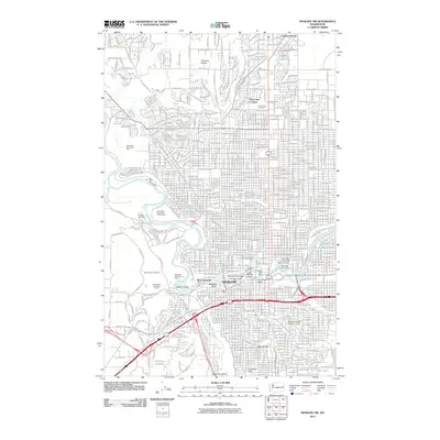
2011 Map of Spokane NW
USGS Topo · Published 2011About this map
Spokane dominates this 2011 survey, showing the city's complex interface with the Spokane River and its dramatic falls. The central urban core is defined by landmark structures like The Flour Mill and industrial-era artifacts including the Monroe Street Dam and Park Powerhouse. The map provides excellent genealogical detail through a significant cluster of large memorial grounds on the western bluffs, including Fairmount Memorial Park, Greenwood Memorial Terrace, and Riverside Memorial Park, adjacent to the winding W Government Way.
Find a feature on this map
77 named features on this map. Tap any name to fly to it.
Don’t see what you’re looking for? This feature index may not catch every label — zoom into the map to look around manually.
Map Details
Editions of this 2011 Spokane NW Map
This is the sole edition of this map. No revisions or reprints were ever made.
Other maps of this area

1901 · Spokane
USGS Topo · 1:125,000

1943 · Medical Lake
USGS Topo · 1:62,500

1944 · Clayton
USGS Topo · 1:62,500

1949 · Deer Park
USGS Topo · 1:62,500

1950 · Spokane NE
USGS Topo · 1:24,000

1950 · Spokane SE
USGS Topo · 1:24,000

1950 · Spokane SW
USGS Topo · 1:24,000

1950 · Spokane NW
USGS Topo · 1:24,000

1950 · Spokane
USGS Topo · 1:62,500

1950 · Clayton
USGS Topo · 1:62,500