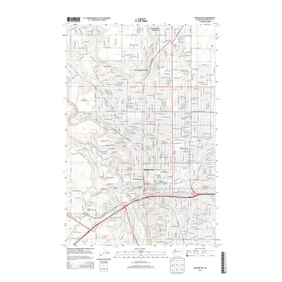
2014 Map of Spokane NW
USGS Topo · Published 2014About this map
Spokane is documented here during a period of sustained urban development, where the Spokane River shapes the city's identity through industrial landmarks like The Flour Mill and the power-generating sites of Havermale Island. The landscape transitions from the dense street grids of West Spokane to the elevated suburban plateaus of Fivemile Prairie and Country Homes. This 2014 survey reveals a significant concentration of memorial and educational institutions, from the sprawling grounds of Fairmount Memorial Park and Greenwood Memorial Terrace to the campuses of Gonzaga Univ and Spokane Falls Community Coll. The rail infrastructure remains a central feature of the local economy, with the BNSF Railway corridor cutting through the heart of the city near the Upper Falls Reservoir. Natural and recreational spaces such as Manito Park and the Downriver Municipal Golf Course are integrated into the urban fabric, while Hangman Creek and Indian Canyon mark the rugged western edges of the city's reach.
Find a feature on this map
231 named features on this map. Tap any name to fly to it.
Don’t see what you’re looking for? This feature index may not catch every label — zoom into the map to look around manually.
Map Details
Editions of this 2014 Spokane NW Map
This is the sole edition of this map. No revisions or reprints were ever made.
Other maps of this area

1901 · Spokane
USGS Topo · 1:125,000

1943 · Medical Lake
USGS Topo · 1:62,500

1944 · Clayton
USGS Topo · 1:62,500

1949 · Deer Park
USGS Topo · 1:62,500

1950 · Spokane NE
USGS Topo · 1:24,000

1950 · Spokane SE
USGS Topo · 1:24,000

1950 · Spokane SW
USGS Topo · 1:24,000

1950 · Spokane NW
USGS Topo · 1:24,000

1950 · Spokane
USGS Topo · 1:62,500

1950 · Clayton
USGS Topo · 1:62,500