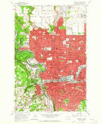
1963 Map of Spokane NW
USGS Topo · Published 1964About this map
Spokane spreads across the plateau and riverbanks in the early 1960s, showing a city defined by its industrial transit corridors and expanding residential districts. The Spokane River winds through the center, marked by the dramatic drop at Spokane Falls and the complex layout of Havermale Island. This period captures the city’s established institutional footprint, from the grounds of Fort Wright and the U S Veterans Hospital to the educational corridor featuring Gonzaga Preparatory Sch and Holy Names Academy.
Find a feature on this map
117 named features on this map. Tap any name to fly to it.
Don’t see what you’re looking for? This feature index may not catch every label — zoom into the map to look around manually.
Map Details
Editions of this 1963 Spokane NW Map
This is the sole edition of this map. No revisions or reprints were ever made.
Other maps of this area

1901 · Spokane
USGS Topo · 1:125,000

1943 · Medical Lake
USGS Topo · 1:62,500

1944 · Clayton
USGS Topo · 1:62,500

1949 · Deer Park
USGS Topo · 1:62,500

1950 · Spokane NE
USGS Topo · 1:24,000

1950 · Spokane SE
USGS Topo · 1:24,000

1950 · Spokane SW
USGS Topo · 1:24,000

1950 · Spokane NW
USGS Topo · 1:24,000

1950 · Spokane
USGS Topo · 1:62,500

1950 · Clayton
USGS Topo · 1:62,500