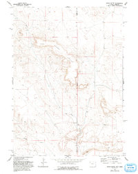
1974 Map of Spoon Butte
USGS Topo · Published 1993About this map
Spoon Butte dominates this High Plains landscape, straddling the state line where Wyoming and Nebraska meet. This 1974 field-checked survey reveals a rugged, sparsely populated ranching environment defined by dramatic elevation changes and ephemeral drainage systems. The boundary between Goshen County and Sioux County bisects the area, highlighting the geographic isolation of these borderlands. Water sources are critical features in this arid terrain, with Sheep Creek and George Draw providing the primary relief to the rolling topography. The presence of the Carpenter Ranch reflects the enduring agricultural heritage of the region, where large-scale landholdings are necessary for cattle operations. The map provides a precise record of the fencelines, tanks, and windmills that supported 20th-century life on the edge of the Nebraska Panhandle.
Find a feature on this map
6 named features on this map. Tap any name to fly to it.
Don’t see what you’re looking for? This feature index may not catch every label — zoom into the map to look around manually.
Map Details
Editions of this 1974 Spoon Butte Map
2 editions found

Other maps of this area

1896 · Patrick
USGS Topo · 1:125,000

1899 · Whistle Creek
USGS Topo · 1:125,000

1954 · Torrington
USGS Topo · 1:250,000

1955 · Alliance
USGS Topo · 1:250,000

1957 · Alliance
USGS Topo · 1:250,000

1958 · Torrington
USGS Topo · 1:250,000

1958 · Alliance
USGS Topo · 1:250,000

1963 · Chalk Buttes
USGS Topo · 1:24,000

1963 · Tea Kettle Rock
USGS Topo · 1:24,000
1963 · Carpenter Ranch
USGS Topo · 1:24,000