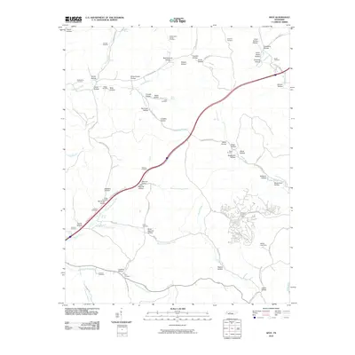
2010 Map of Spot
USGS Topo · Published 2010About this map
Sugar Creek and its many forks define the landscape of Hickman County in this 2010 study, where the terrain is heavily marked by family-named hollows and historic burial grounds. The namesake Spot Cemetery sits near the junction of South Fork Sugar Creek and Old Richmond Rd, serving as a central point for local genealogists. Evidence of early rural infrastructure remains visible in names like Schoolhouse Hollow and the Pinewood Lookout Tower, which overlooks the residential clusters near Wilder Lake Dam.
Find a feature on this map
91 named features on this map. Tap any name to fly to it.
Don’t see what you’re looking for? This feature index may not catch every label — zoom into the map to look around manually.
Map Details
Editions of this 2010 Spot Map
This is the sole edition of this map. No revisions or reprints were ever made.
Other maps of this area

1901 · Colombia
USGS Topo · 1:125,000

1936 · Gorman
USGS Topo · 1:24,000

1936 · Coble
USGS Topo · 1:24,000

1936 · Nunnelly
USGS Topo · 1:24,000

1936 · Whitfield
USGS Topo · 1:24,000

1936 · Bucksnort
USGS Topo · 1:24,000

1936 · Texas Hollow
USGS Topo · 1:24,000

1936 · Spot
USGS Topo · 1:24,000

1936 · Tennessee City
USGS Topo · 1:24,000

1936 · Dickson
USGS Topo · 1:24,000