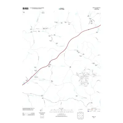
2013 Map of Spot
USGS Topo · Published 2013About this map
The Piney River drainage system dominates this area of Hickman County, where the settlement of Spot sits along the S Fork Sugar Cr. This 2013 survey illustrates the complex topography of the region, defined by dozens of named hollows that have historically dictated the placement of homesteads and small communities. Along Poplar Grove RD, the landscape preserves the memory of local infrastructure with labels like Schoolhouse Hollow and Limekiln Hollow, suggesting the rural industries and educational centers of earlier generations. To the north, Milltown and Poplar Grove remain as established points of interest, while the modern corridor of Interstate 40 cuts a high-speed path through the traditional terrain. Water sources such as Smith Spring and Jenkins Spring appear alongside numerous branches and creeks, including Tumbling Cr and Pemberton Br, highlighting the importance of the local watershed to the development of this Tennessee backcountry.
Find a feature on this map
118 named features on this map. Tap any name to fly to it.
Don’t see what you’re looking for? This feature index may not catch every label — zoom into the map to look around manually.
Map Details
Editions of this 2013 Spot Map
This is the sole edition of this map. No revisions or reprints were ever made.
Other maps of this area

1901 · Colombia
USGS Topo · 1:125,000

1936 · Gorman
USGS Topo · 1:24,000

1936 · Coble
USGS Topo · 1:24,000

1936 · Nunnelly
USGS Topo · 1:24,000

1936 · Whitfield
USGS Topo · 1:24,000

1936 · Bucksnort
USGS Topo · 1:24,000

1936 · Texas Hollow
USGS Topo · 1:24,000

1936 · Spot
USGS Topo · 1:24,000

1936 · Tennessee City
USGS Topo · 1:24,000

1936 · Dickson
USGS Topo · 1:24,000