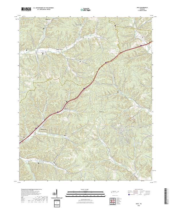
2022 Map of Spot
USGS Topo · Published 2022About this map
Spot and Salt Lick sit at the southern end of a dissected upland landscape where the borders of Hickman, Dickson, and Humphreys counties converge. The terrain is defined by an intricate network of narrow valleys, such as Gordon Hollow and Sparkman Hollow, which feed into the larger drainage of Sugar Cr. This modern survey reveals a countryside deeply rooted in its family lineages, evidenced by the high density of small burial grounds including Wilkens Cem, Tidwell Cem, and McMackins Cem found throughout the hollows. While Interstate 40 cuts a wide swath through the center of the sheet, older routes like Old Beaver Creek Rd and Co Hwy 1779 follow the natural contours of the land. The presence of Wilder Lake and scattered springs like Jenkins Spring underscores the importance of water sources in these remote hollows, where small settlements like Whitehouse and Poplar Grove remain small nodes in a predominantly rural landscape.
Find a feature on this map
116 named features on this map. Tap any name to fly to it.
Don’t see what you’re looking for? This feature index may not catch every label — zoom into the map to look around manually.
Map Details
Editions of this 2022 Spot Map
This is the sole edition of this map. No revisions or reprints were ever made.
Other maps of this area

1901 · Colombia
USGS Topo · 1:125,000

1936 · Gorman
USGS Topo · 1:24,000

1936 · Coble
USGS Topo · 1:24,000

1936 · Nunnelly
USGS Topo · 1:24,000

1936 · Whitfield
USGS Topo · 1:24,000

1936 · Bucksnort
USGS Topo · 1:24,000

1936 · Texas Hollow
USGS Topo · 1:24,000

1936 · Spot
USGS Topo · 1:24,000

1936 · Tennessee City
USGS Topo · 1:24,000

1936 · Dickson
USGS Topo · 1:24,000